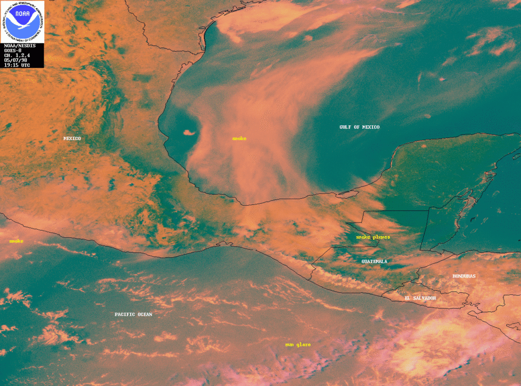
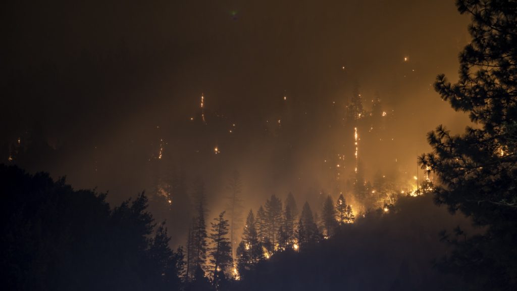
The spring of 1998 is remembered as the second half of the strongest episode of El Niño in the XXth century that caused modified weather patterns around the world leading to heavy precipitation and floods in some regions and droughts in many others. The modified rain patterns were associated with a serious outbreak of the Rift Valley Fever in north-eastern Kenya and southern Somalia, and also were associated with major outbreaks of malaria and cholera in other parts of Africa (https://www.who.int/globalchange/publications/en/elnino.pdf). In Central America and southern Mexico, delayed late-spring rainfall favored generalized fires whose emissions gave rise to several episodes of very poor regional air quality. In one particular week, from 14 to 18 May 1998, the large smoke plume originated in this region was carried by the winds for several hundreds of kilometers and reached the central plains of the United States and states along the Gulf of Mexico. Figure 1 shows a couple of snapshots of the situation on 6 and 14 May 1998 from GOES images from the National Oceanic and Atmospheric Administration (NOAA) of the US.
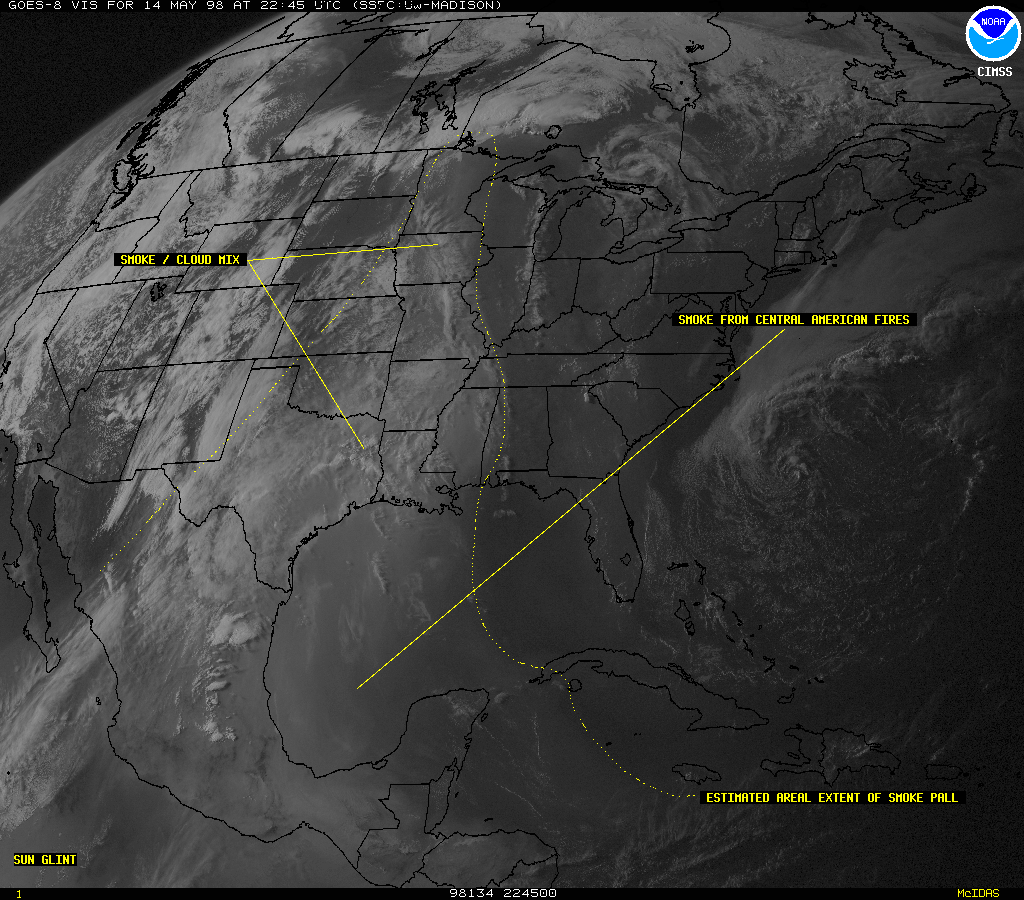
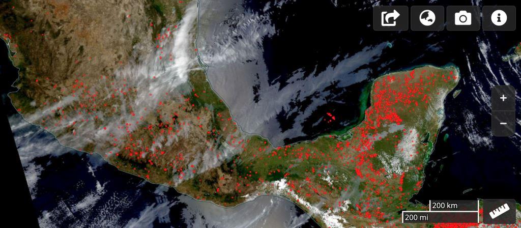
The smoke ingested into thunderstorms over the great plains caused an unexpected increase of the positive cloud-to-ground lightning detected in the US (Lyons et al., 2000; Murray et al., 2002). The fires also contributed to generalized poor air quality in the US due to increases in ambient particle concentrations and ozone (Rogers and Bowman, 2002). The transport of smoke from Central America and Mexico to the US has occurred often since 1998. More recently, as seen in Fig. 2, active fires in the southern Yucatan Peninsula generated a plume that was also transported over the Gulf of Mexico and reached the US coastline.
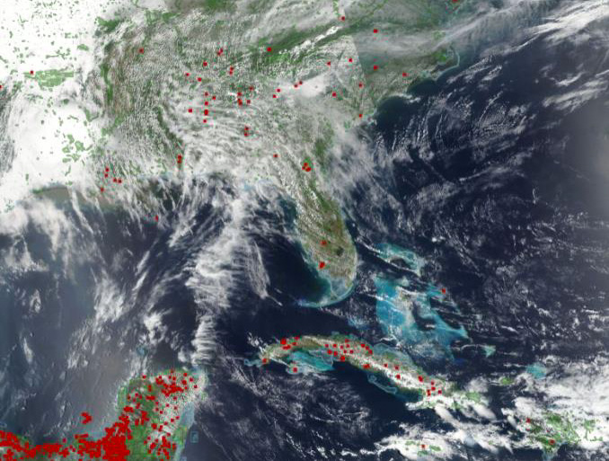
(Courtesy NASA, https://worldview.earthdata.nasa.gov)
As dwellers of large urban centers, we have gotten used to seeing dark clouds of polluting gases and particles hanging over us. And time and again, scientific studies and official reports, e.g. from the World Health Organization (Landrigan et al., 2017), have warned of the dangers of the pollution that we breath daily. Most of the pollution is generated by our own activities, and vehicular emissions have been attributed most of the ambient pollution in the majority of cities, not only in Mexico and Latin America but around the world.
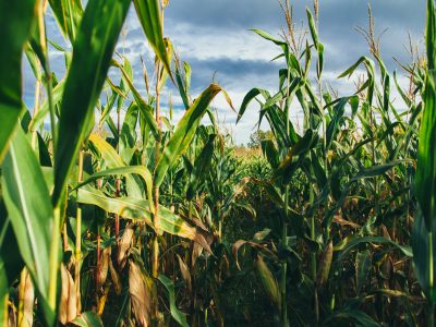
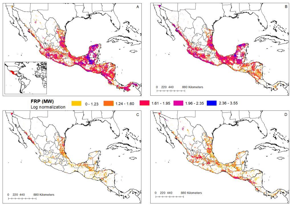
Nevertheless, there are other activities that contribute, albeit seasonally, to worsening the air quality in urban centers and can put large populations at risk. One such activity in Mexico is the agricultural practice of burning residues of different crops. For example, large emissions are associated with sugar cane plantations, which often experience two burning seasons, before and after the harvest. Another practice, which leads to much larger emissions than agricultural burns, involves expanding agricultural regions by clearing up land through cutting down and burning the existing vegetation. Recent studies by Rios and Raga (2018, 2019) provide evidence of the spatial distribution of such fires from 14 years of satellite observations. The seasonal average clearly shows that a large fraction of the country is on fire during the spring (MAM, Fig. 3), but also that burning is observed throughout many regions in late autumn and winter.
The large regions of burned area are, of course, the areal sources of polluting gases and particulates associated with the fires. The total atmospheric burden will depend not only on the fire radiative power (i.e. a measure of its intensity) but also on the evolutionary stage of the fires. Nevertheless, emissions can be estimated from the available satellite observations and a few additional assumptions. These fires result in large quantities of carbon monoxide (CO) and nitrous oxides (NOx), which are toxic to humans, as well as carbon dioxide (CO2) and methane (CH4), which are potent greenhouse gases. Some of the gaseous emissions are precursors to ozone (O3) formation in the atmosphere, another greenhouse gas which affects human health and vegetation. Also, fire emissions contribute large concentrations of aerosol particles of varied composition, including black carbon and polycyclic aromatic hydrocarbons, which are also toxic. Both coarse (PM10) and fine (PM2.5) particles are emitted in the fires, but also some secondary particle formation will occur in the smoke plumes.
Land-use and vegetation databases provide information on the type of vegetation that is burned in the different regions, which is important to estimate emissions. Although the agricultural fires represent nearly 50% of the total fires over Mexico, forest fires dominate the emissions because they have more biomass to burn and can last much longer than agricultural fires. It is often the case that what initiates as an agricultural burn may propagate to surrounding land parcels and end up covering much larger areas. The study by Ríos and Raga (2018) shows clearly that the tropical humid forest and tropical dry forest dominate the areas burned, for both total and agricultural fires.
Croplands and grasslands contribute similar burned areas in several months during the dry season. But there is a steady increase in the area of burned forests to reach a maximum in May, surpassing the combined burned area of croplands and grasslands.
Interannual variability of burned area and emissions
As with many phenomena, there is a large year-to-year variability in the burned area, and in the associated emissions. Within the 14-years studied by Rios and Raga (2018, 2019) 2005 and 2011 show up as extremely active years, while spring of 2014 is the least active in the period. It makes sense to think that part of the interannual variability in burned area may be related to the modulation of atmospheric conditions by well-known phenomena, such as the El Niño Southern Oscillation (ENSO), since a delayed start of the rainy season and overall dryer conditions may influence fire propagation.
During the spring of 1998, when the smoke of large fires reached the great plains of the US and modified the thunderstorm electrification process, the eastern equatorial Pacific still experienced very warm waters in March-April-May and started to retreat back to the western Pacific in June, causing subsidence over Central America and southern Mexico and delayed start of rainy season. These conditions were associated with the large fires that season. In contrast, in the spring of 2011, which shows the largest burned areas in the period 2001-2014, the La Niña phase of ENSO with cooler waters was still present in the eastern equatorial Pacific. These lower ocean temperatures are associated with reduced precipitation and later onset of rainy season in southern Mexico. And the spring of 2005, the second largest in terms of burned area, was a neutral year in the Pacific, but clearly the rains were delayed in the western Mexico and even June had less rain than average in Yucatan. These examples highlight that ENSO modulation may not be the only factor affecting the extent of the burned area over Mexico and Central America. Other factors, such as changes in cash crops driven by international prices, may be at play.
What is in the future for this 2020 fire season?
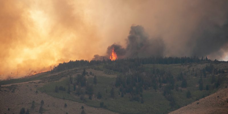
A recent image of active fires from VIIRS (Fig. 4) provides evidence of the widespread nature of burning on any particular day, e.g.12 April 2020, in central and southern Mexico. It is more likely that fires will get out of control when atmospheric conditions are hotter and dryer than normal. Such conditions lead to the presence of dryer fuel lying around, that more readily could catch fire and rapidly propagate.
Other countries have studied the most favorable conditions for out-of-control fires, which include temperatures higher than a certain threshold that will depend on the geographical characteristics. These thresholds need to be determined for the different ecoregions in Mexico. The climatological value for maximum temperature in many regions of Mexico is observed in late spring, before the transition to the rainy season and coinciding with the active fire season. Also needed for fire propagation, are low relative humidity and scarce precipitation, conditions often observed in late spring in Mexico. And the last atmospheric ingredient is high winds, which will foster fire propagation and make difficult the work of firefighters.
Based on the North American Drought Monitor from NOAA, the National Weather Service of Mexico issues an overview of the situation over the past 15 days. It highlights the regions that are experiencing drier than normal conditions up to severe drought conditions. The most recent update (valid for 31 March 2020), indicates that most of the Yucatan Peninsula has been experiencing a moderate drought. Several central-western and along the southern Pacific coast also have been drier than normal, all of which provides favorable conditions for fire propagation in many of the areas that have seasonal fires. (Available at https://smn.conagua.gob.mx/es/climatologia/monitor-de-sequia/monitor-de-sequia-de-america-del-norte)
Seasonal forecasts can give us some insight into the conditions that will prevail this late spring of 2020. Seasonal forecasts provided by the International Research Institute for Climate and Society at Columbia University (https://iri.columbia.edu/our-expertise/climate/forecasts/seasonal-climate-forecasts/), are issued on a monthly bases for the following trimester. The forecast issued in April for the May- June-July 2020 period indicates that western and NW Mexico as well as the Yucatan peninsula, have a slight chance of being warmer than normal, while the precipitation forecast indicates a normal spring, with no delay in the start of the rainy season. These warm conditions would increase the likelihood of out-of-control burning in those regions and lead to enhanced emissions and potential for regional pollution.
Will smoke from fires negatively impact patients affected by COVID-19?
The short answer is we do not know.
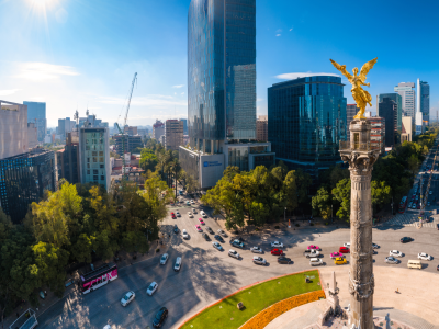
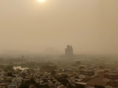
This year has seen the unprecedented spread of the SARS-COV2 virus, which has caused infections in all continents and which is currently very active in Mexico. Most cases so far have been reported in the large cities: Mexico City and the surrounding municipalities in the State of Mexico, Puebla, Guadalajara, which are all located in the 19-22N central latitude belt, as well as Monterrey in northeastern Mexico and Tijuana and Mexicali in northwestern Mexico. These cities often exceed the national thresholds (that are higher than the WHO guidelines), and in particular in Mexico City, millions are exposed daily to high concentrations of fine particles (PM2.5) even though the government has implemented several mitigation measures over the last three decades. These elevated PM2.5values have been linked to increases in premature mortality (SEDEMA, 2018; Evans et al, 2019). A very recent study carried out by scientists at the Harvard Chen School of Public Health, in several cities across the US (Wu et al, 2020), has already warned that the elevated PM2.5 values may have likely caused several hundred additional COVID-19 fatalities, caused by the SARS-COV2 virus, just because people were exposed to bad air quality.
Since already there is a vulnerable population in Mexico due to the poor air quality, it is fair to ask how the regional air pollution associated with biomass burning will affect the people that will get infected with the SARS-COV2 virus this spring. Mexico City, Guadalajara, Puebla and Monterrey are all located near seasonal sources of agricultural burns and can be subjected to the transport of smoke from those fires that further exacerbates the poor air quality observed in all of them.
It would be particularly important this year if the federal and state authorities would put into effect a protocol to prevent the burning of agricultural residues and more importantly, to control the expansion of the agricultural regions by topping and burning woody vegetation in shrublands and forests. And in the event of out-of-control fires, authorities need to be ready to deploy personnel to rapidly respond and extinguish them. Additionally, meteorological conditions need to be assessed continuously to determine the probability of regional transport. Early action will prevent the smoke reaching the large cities located in central Mexico in which large populations would potentially be affected.
We acknowledge the use of imagery from the NASA Worldview application (https://worldview.earthdata.nasa.gov), part of the NASA Earth Observing System Data and Information System (EOSDIS). We also acknowledge the International Research Institute for Climate and Society at Columbia University for making seasonal forecasts available (https://iri.columbia.edu/our-expertise/climate/forecasts/seasonal-climate-forecasts/).
References
Evans, John, Leonora Rojas-Bracho, James K. Hammitt & Douglas W. Dockery, 2019: Health Benefits of Air Quality Improvements in Mexico City: Emission Controls for Heavy Duty Vehicles. https://cdn1.sph.harvard.edu/wp-content/uploads/sites/1273/2019/09/Evans-Rojas-Bracho-Hammitt-Dockery-2019.pdf.
Landrigan, Fuller, Acosta, Adeyi, et al., 2017: The Lancet Commission on pollution and health. DOI:https://doi.org/10.1016/S0140-6736(17)32345-0
Lyons, W. A., T. E. Nelson, E. R. Williams, J. Cramer, and T. Turner, 1998: Enhanced positive cloud-to-ground lightning in thunderstorms ingesting smoke from fires, Science, 282, 77-81.
Monitor de Sequía, Servicio Meteorológico Nacional, CONAGUA, México. https://smn.conagua.gob.mx/es/climatologia/monitor-de-sequia/monitor-de-sequia-de-america-del-norte.
Murray, Natalie, Richard Orville, Gary Huffines, 2000: Effect of pollution from Central American fires on cloud‐to‐ground lightning in May 1998. Geophys. Res. Lett., 27, 2249-2252. https://doi.org/10.1029/2000GL011656
Rios, Blanca, 2019: “Quemas agrícolas en México y Centroamérica: Contaminación por gases y partículas.” Doctoral Thesis, Earth Sciences Graduate Program, UNAM
Rios, Blanca and Graciela B. Raga, 2018: Spatio-temporal distribution of biomass burning by ecoregions in Mexico and Central America. Int. J. Remote Sens. 39, 949-970. (1.782) https://doi.org/10.1080/01431161.2017.1392641.
Rios, Blanca and Graciela B. Raga, 2019: Smoke emissions of air pollutants from agricultural fires by ecoregions in Mexico and Central America. Int. J. Remote Sens. 13(3), 036509 (1.782) doi: 10.1117/1.JRS.13.036509. ISSN: 2352-9385.
Rogers, C. M. and K. P. Bowman, 2002: Transport of smoke from the 1998 Central American Fires, American Geophysical Union Spring Meeting, May 30-June 3, Washington DC.
SEDEMA, 2018: Análisis histórico de los beneficios en la salud asociados a la calidad del aire en la Ciudad de México entre 1990 y 2015. (http://www.data.sedema.cdmx.
Trujano, Fabiola, 2019. Trabajo de Investigación para obtener el Grado de Licenciatura en Fisica, Facultad de Ciencias, UNAM.
Wu, Xiao, Rachel C. Nethery, Benjamin M. Sabath, Danielle Braun, Francesca Dominici., 2020: Exposure to air pollution and COVID-19 mortality in the United States. medRxiv 2020.04.05.20054502; doi: https://doi.org/10.1101/2020.04.05.20054502
Dr. Graciela B. Raga is a senior scientist at the Center for Atmospheric Sciences at UNAM in Mexico City. She has been involved over the years in a variety of research projects in the atmospheric sciences, on topics such as: urban air pollution, black carbon, cloud microphysics, electrification and cloud dynamics, mesoscale meteorology and tropical cyclones, aerosol-cloud-climate interactions and short-lived climate pollutants. She is currently the head of the Micro and Mesoscale Interactions research group and the Editor in Chief of Atmosfera.